AdobeStock/madeaw
Silhouette of a drone in twilight.
In the past week, unidentified drones have been observed repeatedly over Luxembourg’s airspace, causing flight interruptions and delays at Findel airport. It’s the first time this has occurred in Luxembourg, but similar incidents have happened over the past years in other countries. While officials have stated that the recent drones over Luxembourg do not pose a danger to the public, details about their type and origin have not been communicated at the time of writing.
We spoke to Assistant Professor Grégoire Danoy from the University of Luxembourg about the scientific technologies available to detect and trace drones, and what possibilities exist to deflect or intercept them. The computer scientist’s research team has been working since 2017 on how swarms of AI-controlled drones could protect critical infrastructures such as airports against potential intrusion drones.

Photo: Grégoire Danoy
Grégoire Danoy, how can you detect unidentified and potentially unauthorised drones ?
Scientifically speaking, there are many existing approaches and also still ongoing research activities. Currently, there’s no single detection method that is reliable in every situation. If we take the case of what happened in Findel and in other places, one of the challenges is that it happened at night. Some technologies are more fit for this than others.
Generally speaking, the idea is also not to have too many false alarms. The way forward is to have an optimised combination of complementary sensors – adapted to the size of the drone, the conditions, the weather, etc.
What are the different scientific technologies behind these sensors?
One of the classical techniques you can use, also at night, is radar detection. So radio waves that are sent out and reflected by the drone. This can work over several hundred meters. One of the challenges with this method is that drones can be pretty small and so the echoing signature can be also be very small. So this is not always very reliable, or the detection range can be very short. You also have obstacles in the air space or potentially reflections in the environment that can affect your measurement.
Another method is radio monitoring – if drones are remotely operated. Because to operate a drone, radio frequencies are used to transmit the video feed for example. And these transmissions can be detected by sensors that pick up the link between the operator and the drone – also in darkness. This is quite different from classical air traffic control.
Then you can also use vision-based systems. You can use ordinary cameras but they don’t work well at night. But you can use thermal cameras, because drones have a different temperature than the background. This will still be dependent on the weather and on the heat contrast but you can use it also in darkness.
Another type of sensor is acoustic. You can detect the sound signature of drones, characteristic of rotating blades. But again, that's challenging when you are close to airports, because you will obviously have the sounds of aircrafts, the traffic or the wind. These could mask the drone sounds.
Then you have other laser-based sensors or LIDAR systems. They work also at night and in a similar way to radar detection systems: it measures how long an emitted signal takes to bounce off the drone and returns. But instead of using radio waves with longer wavelengths (mm to cm), it uses laser light with much shorter wavelengths (micrometers or nanometers). But it operates over shorter distances than radars and if the weather is foggy or rainy, you have also limitations.
One last one that I could mention, that is still an active research area, is electromagnetic signatures: the electromagnetic emissions of the motors or the electronics on board of the drones. They’re pretty weak, but you could detect them – at short distances.
If used in combination, do these detection methods only provide information about the location or also about size or type of drone?
So obviously, if it's a camera, it can give you information about size. With radar, and with LIDAR, you could distinguish some shapes, or you could see if it's like a fixed wing or a multi-rotor drone. And if you manage to track it, then you have different flight patterns you could observe. A fixed-wing drone will not fly the same way as a multi-rotor drone.
Which is another question: Do any of these methods allow you to track where a drone came from, or to locate a potential operator?
That’s a very good question. Detecting drones does not mean that you know where it's coming from.
You can use radio localisation if the transmissions between operator and drone are detectable and the sensor coverage is sufficient. That can help to locate the controller – if there is one – but it can give no information about who is using the controller. If a drone is programmed, it may still have a control link. But without an active link, there may be no controller transmission to locate.
Some drones might even be controlled with the communications network, like 4G or 5G. That makes it harder to trace back where a potential pilot was. Because 4G/5G allow to extend the range of the mission, which means that the operator can be quite far away.
Then you have a remote ID that you can track if the drone is registered. Remote ID can provide identification and position information, but may be absent or unreliable. It can help identify the registered operator, without proving who was piloting or whether the flight was authorised.
If one manages to capture the drone, can you read out any information about its origin from the actual hardware or software on board?
It depends on the hardware. There's so much variety in the types of drones: they can go from the tiny, like less than 200 grammes drones up to really huge fixed-wing ones that are the size of a small plane. Investigators may recover serial numbers, flight logs or stored images, depending on the equipment and available data.
What defence mechanisms exist against such drones – methods to potentially deflect, interfere, capture or destroy unwanted drones over critical infrastructures?
That's a big subject since many years. There are still many open questions and different types of technologies exist – from electronic methods to more physical interception. Again, it really depends on the situation and on the location.
In terms of electronic methods, the classical method is jamming: You try to interfere with the communication of the drone or disrupt the satellite navigation signals. The problem here is that you have no guarantee on how the drone will respond to this type of intervention.
- Maybe the drone will land.
- Maybe it will hover.
- Maybe it will return to base, and that could help with tracing it. Some commercial drones have this function, but it is not guaranteed to work under jamming.
- Or maybe it will just continue flying or drift or become uncontrollable, which is not something you want to happen above of an airport or an urban area.
Another electronic approach is spoofing, which is a bit different from jamming. There you basically send false position data to try to mislead the drone.
Both jamming and spoofing may affect other receivers, including aircraft navigation systems.
A separate approach is to take over control of the drone. To achieve this, you need to be able to exploit some weaknesses in the software or in the communication protocols. In theory, this could be possible for some models and configurations of drones, but it’s super difficult to have a comprehensive set of solutions there. So that's only applicable to a very reduced set of systems.
Then you have some systems using laser technology, so a directed beam of energy that disables electronics or damages the drone. For this you need very accurate tracking and good visibility. This is probably not the best approach over an airport though, as there are risks for eye injuries, fire and damage from falling debris.
Another approach is physical interceptions. For example, you can throw nets from the ground or from other drones to capture the drone. But this could also lead to collisions or falls.
And finally you can create destructive interception. You now see more and more small super-fast drones that can fly like 300 km/h, they're being developed quite extensively lately. These could work as interceptor drones that collide with the target, similar to gunfire and missiles. But then again, most probably this cannot be used in every situation – like over airports where safety of citizens is a concern.
As we can see, it’s still quite a challenge to design a safe, efficient system to defend the airspace above critical infrastructure or urban areas. There's no perfect solution; the best way would be a combination of solutions that have to be optimised and coordinated to provide a good defence against potential threats.
Your research team at the University investigates another defensive countermeasure solution. What does this entail?
Our idea is to develop an AI-controlled swarm of coordinated drones as a protective and exclusively defensive system for critical infrastructures such as airports. We've seen that most of the existing countermeasure solutions introduce some risk of fall or debris. We thought about proposing a solution that although it will not fit all scenarios, it may fill a gap that exists.
Over recent years, we have been working on the case of a counter-acting swarm versus a single intruder. We designed new machine learning techniques, so new AI, to automatically obtain an efficient behaviour for a swarm of drones.
In our current research, we move to the next step: we investigate what happens if it’s not just a single intruding drone, but a swarm of intelligent drones trying to enter for example an airspace. This is yet another challenge.
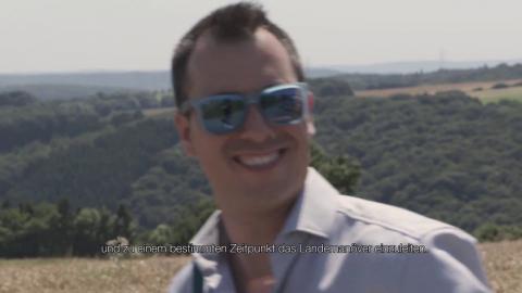
Above: Video about the PhD project of Florian Felten, which included the work on drone swarms vs single intruding drone. Florian Felten won an FNR for Outstanding PhD Thesis from the Luxembourg National Research Fund (FNR) in 2025.
What would the counter-acting swarm of drones try to achieve?
So again, they could try to defend the airspace and deflect intruding swarms of drones. So potentially get close and escort intruding drones away from the protected area. And this in an intelligent way: that the swarm would adapt its movement, shape, split, etc. – inspired by swarms in nature.
Currently, this is still purely in a research stage and we are testing this in an indoor lab in controlled environments. Moving to outdoor operations would require further safety validation and clarification of the applicable authorisation conditions with the aviation authorities. And of course we are also working on building safety mechanisms in the AI we develop to ensure you have control over what the system can do.
More information on the research project’s website and the website of the researcher.
Interview: Michèle Weber (FNR)
Editor: Jean-Paul Bertemes (FNR)